
Laos Things to do and see
VIENTIANE
The original Lao capital was established in 1353 at Luang Prabang, the heart of the Kingdom of a million Elephants. In 1560 the capital was moved by King Setthathirat, who was concerned with the threat of a Burmese invasion. The new capital, Vieng Chan, meaning "Walled City of Scandal Wood", located on a bend in the Mekong River, was originally one of the early Lao river-valley fiefdoms. The Lao that settled here chose the area because the surrounding alluvial plains are so incredibly fertile.
In 1824 the Siamese invaded and sacked Vieng Chan, destroying everything except for a single temple, which they may have spared due to its Siamese style. When the French arrived at the end of the 19th century, they found the town in ruins and overgrown by jungle. "Vientiane", which is the French transliteteration of the Lao name Vieng Chan, was partially rebuilt during the colonial period, with French-style buildings and houses. Vientiane is small, charming and picturesque. It contains some colorful and sacred pagodas, fascinating museums, wide boulevard and attractions like Patuxai, Vientiane's Arc de Triumphed.
Main Sites
THAT LUANG
Situated on the top of a hill three kilometers northeast of the town, That Luang (Great Stupa) was built in 1566 by King Setthathirat. Supposedly erected on the site of an ancient 11th century Khmer temple, That Luang is, according to a legend, the resting place of a relic of the Buddha brought to Laos in the 3rd century by Buddhist missionaries from India. That Luang is the most important national monument in Laos, a symbol of both the Buddhist religion and Lao sovereignty.
WAT SISAKET
The only temple spared by the 1827 Siamese invasion. Wat Sisaket, built in 1818 by King Anouvong, is Vientiane's oldest edifice. Small niches carved within the cloister and the main sanctuary contain 6,842 images of the Buddha in bronze, silver, wood and clay, most of which date from 16th to 19th century. The sanctuary 's inner panels are covered with 19th century murals depicting the jataka, stories of the previous lives of the Buddha. At the left of the cloister's entrance, there is a Burmese style library, which opens on to Lane Xange Avenue.
HO PHRA KEO
This former monastery, at one time the most important in Vientiane, has been transformed into a museum. Wat Ho Phra Keo was built in 1656 by King Setthathirat to house the Emerald Buddha image and to serve as the King 's personal place of worship.
This image can now be viewed in Bangkok, in a temple of the same name. In 1779 the Siamese pillaged this much-venerated image and carried it off to Siam where it remains to this day.
PATUXAI (VICTORY GATE)
Situated at the top of Lane Xang Avenue, the Triumphal Arch has little to do with its Parisian equivalent.
WAT SIMUANG
Wat Si Muang is the most heavily worsshipped in all of Vientiane, it is located at a three-way intersection where Setthathirat Road and Samsenthai Road converge to become Tha Deau Road.
Legend has it that the spot was selected in 1563 as the site for a new wat by a group of sages when King Setthathirat moved the capital to Vientiane. It is the site of la'k meuang (city pillar/phallus), the local believe this immage has the power to grant wishes or answer troubling questions.
GARDEN OF BUDDHAS
Located 25 km southeast of the capital along the banks of the Mekong River, it was built in the late 1950s by a priest who invented a syncretism doctrine mixing the Hindu and Buddhist religions. This park contains sculptures of gods from both pantheons.
ANG NAM NGUM
Nam Ngum Lake, 90 km north of Vientiane is a 250 square km artificial reservoir that has an intriguing secret beneath its surface. Travelers can enjoy sailing and fishing on this placid lake.
VANG VIENG
Dubbed the "Small Lao Guikin", Vang Vieng is located 156 km north of Vientiane on the road to Luang Prabang (Highway 13). The town is famous for its limestone cliffs peppered with caves and caverns, which are found in an area two kilometers to the southwest.
LUANG PRABANG
The oldest and loveliest of Lao cities, Luang Prabang was founded between the 6th and the 7th centuries when it bore the name Muong Sua.
In 1353 Luang Prabang became the capital of King Fa Ngum 's Kingdom, Lane Xang (the Kingdom of a Million Elephants). The king, raised at the royal court at Angkor, was presented with a golden image of the Buddha, the Phra Bang, said to have been cast in the 1st century in Sri Lanka. As Buddhism spread throughout Laos, the image became the city 's talisman, and so Muong Sue became Luang Prabang to reflect this important symbol of the new faith.
Luang Praabang is one of the most serene towns in ASEAN. Much of the towns and its pagodas are protected as a UNESCO World Heritage Site.
Main Sites
WAT XIENG THONG
Overlooking the Mekong, this temple, which was formerly used for royal ceremonies, is the city 's most striking. Constructed in 1560, the main sanctuary is amazing with its mosaics of colored mirrors, details in intricately carved wood and, above all, its graceful rooftops sloping downwards to the ground. It is one of the best examples of the Luang Prabang architectural style.
WAT MAI
This temple, dating to 1788, is famous for its five-tiered rooftop and its facade decorated with golden bas-reliefs, which depict the legend of Phravet, one of the last incarnations of the Buddha. The construction of this temple took 70 years.
MOUNT PHOUSI
The hill situated in the middle of the town affords a magnificent panoramic view of Luang Prabang and beyond. For this alone it is worth climbing the 329 steps leading to the summit, especially at sunset.
THE NATIONAL MUSEUM
The former royal palace, built from 1904 to 1909 by the French, was transformed into a museum after the 1975 revolution. It contains displays of religious objects, a collection of gifts presented to the royal family, including a moon rock from an Apollo mission presented by the United States. The pride of the collection is the famous Phra Bang Buddha image, 83 centimeters tall and weighing 50 kilograms.
Around Luang Prabang
Kuangsi Waterfall _ Located 30 kilometers from Luang Pra Bang, this is a pleasant place to spend warm afternoons swimming in a picturesque setting.
Pak Ou Caves This is the most popular day trip on the Mekong for visitors with limited time.
Tham Ting and Tham Poum Caves Located on the side of a cliff contain more than 4000 Buddha images of various shapes and sizes. Lao pilgrims traditionally come here during Lao New Year in April. On the way, you can stop at Ban Shang Hai, a rice whiskey distillery and have a swim at the foot of the cliffs near the caves.
Ban Phanom This village of Tai Lue weavers an ethnic group originally from Yunnan Province in China, is 4 km east of Luang Prabang. The whole village is involved in the activity of weaving silk and cotton. Their wares are solon the spot, at a small central market.
LUANG NAMTHA
A small town situated in a valley and surrounded by rice fields and deforested mountains, Luang Nam Tha is like so many places in this area recovering from war with a large modern quarter and an older sector. It looks a bit like one of those Wild West towns built along straight road. There is a colorful open-air fruit and vegetable market two blocks away from the covered market.
MUONG SING
Located 58 km from Luang Nam Tha, Muong Sing is a charming little town despite indications that the modern world is quickly making inroads. The morning market, one of the most colorful in the region, attracts a great variety of tribal minorities, including the Akha (lko) with their short skirts and their headdress decorated with old Bank of Indochina coins.
NONG KHIAW – MUONG NGOI
Divided by the Nam OU river, used to be known as Muong Ngoi. Nong Khiaw on the western bank of the river is now the more predominant part of the town as it has the boat pier. Muong Ngoi, on the other side of the bridge, offers a great view of the river. This picturesque village surrounded by limestone cliffs is situated half way between Luang Prabang and Muong Khoua. From there, it takes two days over difficult roads to reach Sam Neua, 300 km away.
PHONGSALI – MUONG KHOUA
Phongsali, the northern most provinces is also one of the most isolated and untouched in the country. In the forest one may still encounter rare and endangered species of animals and plants. Phongsali is a peculiar small town with paved streets and an abundance of flowers.
Its 1,500meter altitude makes for cool weather and heavy rainfall during the wet season. Muong Khoua is located on a hill at the mouth of Nam OU and Nam Phak; this is a transit point for those traveling via the river and the highway. This village could see more tourists when the border with Vietnam at Dien Bien Phu opens to foreigners.
XIENG KHOUANG (THE PLAIN OF JARS)
Phonsavanh _ often called Xieng Khouang, (the name of the former capital almost destroyed by US bombing) is a commercial boomtown. The vast of stretch of land around Phonsavanh is home to one of the greatest archeological mysteries on earth. How and why were the several hundreds stone jars left scattered over the area? Who put them there? Where did the jars originate?
THAKHEK
Tha Khek, 360 kilometers south of Vientiane on highway 13, is a small, pleasant town with a collection of French colonial buildings that are still in good condition. It is another stop on the road south or can also be a starting point if you enter Laos here from Thailand. There are limestone cliffs along highway 12 toward Mahaxai that make for a scenic panorama.
SAVANNAKHET
This large town on the Mekong seems to be taking advantage of its strategic location and is becoming an important transit point for trade between Thailand and Vietnamese part of Danang. The town still has a few structures from its colonial past.
PAKSE – CHAMPASACK
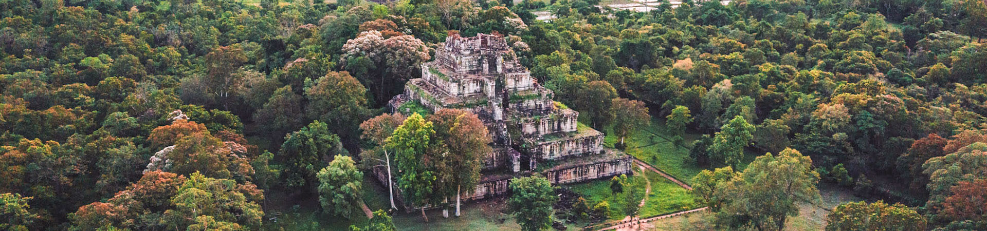
Located 770 km south of Vientiane, at the confluence of the Mekong and Sedon rivers, Pakse is an important transit point for trade between Laos, Vietnam, Cambodia and Thailand. Champasack also known as Ban Wat Thong, located 36 km to the southwest of Pakse, this is the nearest village to Wat Phou (which is located 11 km to the south). Wat Phou, sometimes referred to as “ Little Angkor “, is by far the most impressive Khmer ruin in Laos. Begun during the Chenla kingdom (6th to 8th centuries), the first buildings actually pre-date the temples at Angkor. Archeologists believe there was once a read linking Wat Phou to the Khmer capital at Angkor.
DON KHONG (KHONG ISLANDS)
Don khong, the largest of the Mekong’s island, is located 135 km from Pakse and is a very pleasant place to spend a few days. On foot or by bicycle, you can explore the rustic villages and their archaic temples, stroll though gardens and rice fields, or select the perfect place to watch the setting sun.
MEKHONG WATERFALL (KHONE PHAPHENG)
Near the end of its 1,600 km course through Laos, just before reaching Cambodia, the Mekong splits into numerous branches to form a labyrinth of islands. At this point the Mekong is at its widest, at approximately 14 km. It is also here that formidable rapids dash the hopes of a navigable Mekong from China to Vietnam.
BOLAVEN PLATEAU
This plateau, with an average altitude of 1,200 meters, is one of the country’s most important agricultural areas. There are currently some projects underway to increase the production coffee for export. There are also plantations culturing spices such as cardamom and fruits such as durian. Tall wild teak tree are often used to shelter coffee trees. The Bolaven plateau and its surroundings are also home to an impressive number of the ethnic minorities who are quite distinct from those living in the north of Laos.
SALAVAN
Salavan is located 127 km from Pakse on the river Sedon; this small town was totally rebuilt after the war. The natural lake of Nong Bua, 14 km east of town near the source of the Don River, is famous for its crocodiles, which are most abundant during the rainy season.
ATTAPEU
Officially called Muong Samakhi xai, the capital of Attapeu province is set in a large valley surrounded by mountains and river, and is famed in southern Laos as the “garden village)” for its shady lanes and lush flora. The town’s location at the confluence of the Xe Kong and Se Khamane River makes it perfect for exploration by boat. The flat-topped line of mountains about 1,000m over the valley floor to the north and west marks the edge of the Bolaven plateau and offers the country’s most dramatic view of this celebrated geographical entity. To the east of capital are the most heavily bombed districts along the Ho Chi Minh Trail.
More Articles on Destinations

Cambodia Facts
Vietnam Facts
Laos Facts
Myanmar Facts
Cambodia Things to do
Vietnam Things to do
Laos Things to do
Myanmar Things to do
Cambodia Tours

Cambodia Day Tours

Angkor Temple Tours

Cambodia Classic Tours

Promotion Tours

Adventure Tours

Cycling Tours
Trip Planner
Useful Links
Travel Services
News & Media
Agency offering information about Cambodia on tourism, culture, history, visa, attractions, province guides, trip planner, hotels, flights, cars, tours, news, photo and online bookings.
#262D, Monivong Blvd., Sangkat Beung Raing, Khan Daun Penh.Click here to contact us.