Geography - Pursat, Cambodia
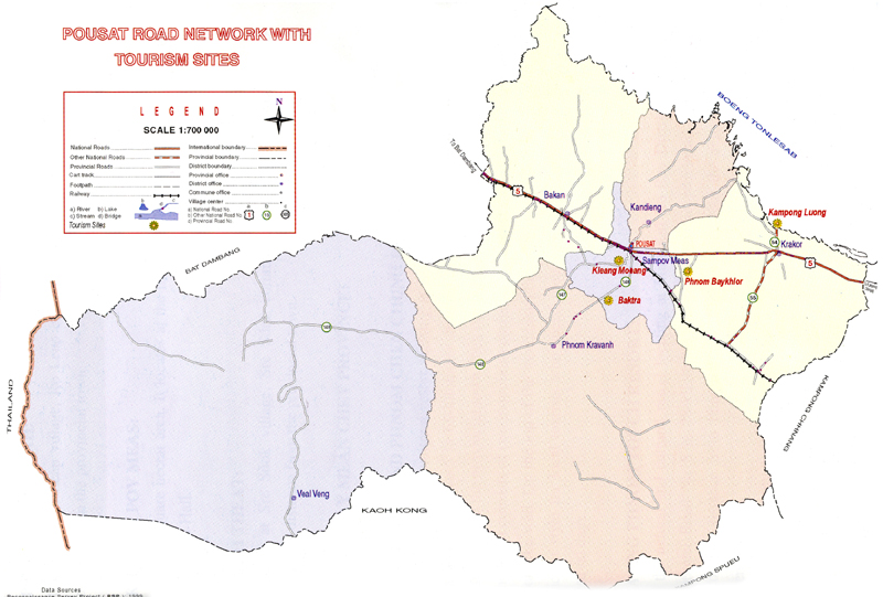
Pursat province is 12,692 square kilometres big. It?s located in the Southwest of the country and is bordering to the North with Battambang, to the East with Kampong Chhnang, to the South with Kampong Speu and Koh Kong and to the West with Thailand. The province consists of some typical plain wet areas near the Tonle Sap Basin, covering rice fields and other agricultural plantations. The Tonle Sap itself covers a big part in the province?s Northeast. Most surface area of the country is the Kr?vanh Mountains, or literally called "Cardamom Mountains". This is a green, forested mountain range in the southwestern part of the province, near to the border with Thailand. The highest elevation is the 1,813m high Phnom Aural in the Southeast corner of the country.
|
Bak Tra Resort
The Bak Tra Resort, Pursat is a very popular destination in the area and it should not be missed. The beauty of the place will surely amaze you like none else. You
details... |
|
Cardamom Mountains
Check the Koh Kong chapter for information on the fried from Koh Kong to Pailin, which cuts through the Cardamom Mountains on the western edge of Pursat province.
details... |
|
Floating Village of Lake Tonle Sap
Floating Village of Lake Tonle Sap is heading east from Pursat town, about one-third of the way to Kampong Chhnang town is the town of Krakor. Just a few kilometers
details... |
|
Kam Pong Luong Resort
Kampong Luong is a natural site located on the Tonle Sap in Kampong Luong commune, Krakor district, about 35 kilometers east of Pursat provincial town. The site is a
details... |
|
Leach Village
It is visited by both locals and foreign tourists. The scenic beauty of the Leach Village, Pursat matched with the rich rustic tradition has made it a very popular
details... |
|
Luaing Trach
Luaing Trach is located in Lang Trach village, Svay Sa Commune, KraKor district, about 49 kilometers (1h:30mn) from Provincial Town. It is Nature &
details... |