Geography - Rattanakiri, Cambodia
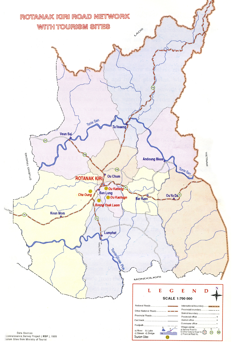
Ratanakiri is situated on the north - east plateau (approx. altitude around 200-400 metres), 636 Km from Phnom Penh. It is bordering Vietnam on the east, Laos PDR on the North, Steung Treng province on the West and Mondulkiri on the South. There are two bigger rivers crossing the province ( Sre Pork and Sresan River ). The total area of Ratanakiri is about 10,782 square kilometres.
|
Beung Yeak Loam
Beung Yeak Laom is located in Yeak Loam commune, Ban Loung district, about 5 kilometers south of Ban Loung provincial town. A lake in the middle of a mountain, it
details... |
|
Cha Ong Waterfall
Cha Ong waterfall is in the forest in Cha Ong village, O'Chum commune, about 2 kilometers west of Ban Loung provincial town. It was given its name by the Kreung hill
details... |
|
Eisey Patamak Mountain or Phnom Svay
Phnom Eysei Patamak, which is also known as Phnom Svay,is about 2 kilometers west of Ban Loung provincial town. At the foot of the mountain is Wat Isana Rattanaram,
details... |
|
Ka Chanh Waterfall
Ka Chanh waterfall is located in Ka Chanh commune, Ban Loung district, about 6 kilometers southeast of Ban Loung provincial town. The waterfall is 12 meters high and
details... |
|
Ka Tieng Waterfall
We went to see 3 waterfalls in total, visiting Ka Tieng, Kinchaan and Chaa Ong. To get to Ka Tieng. we had to go through a small river with the bike, which was
details... |
|
Lumphat Wildlife Sanctuary
Lumphat Wildlife Sanctuary is situated 37km. south of Banlung. With a total land area of 250,000 ha. there are special kinds of animals and birds like tigers,
details... |